

Project Summary
Problem Statement
Target Audience
Commercial Complexes
Shopping Malls
Event Venues
Hypotheses
People often forget where they parked in malls, airports, and large event venues.
Lack of signage or visual cues in parking areas leads to confusion.
Distractions while parking reduce the chance of remembering the location.
Crowded environments increase the chances of misplaced vehicle recall.
Most users rely on memory, not tech, to find their parked vehicles.

Research & Insights
To understand how people experience the frustration of losing their parked vehicles, I followed a mixed research approach — combining real-world observations, user interviews, and supporting data.
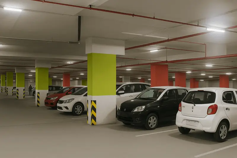
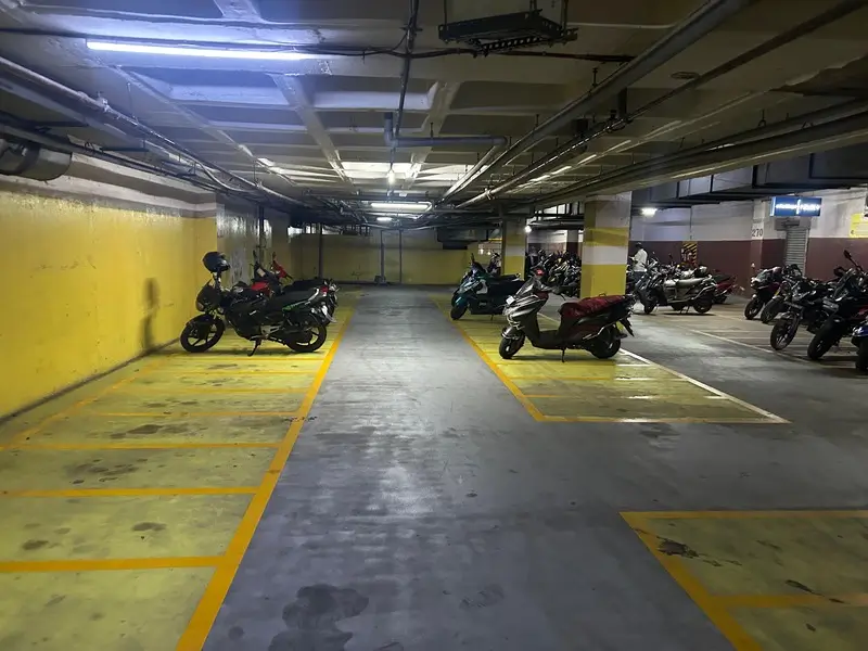
Field Visit to Parking Areas
I personally visited a few malls with large indoor parking lots to speak directly with people at the parking exit points. While I wasn’t allowed to record videos or conduct formal interviews on-site,
I had casual, one-on-one conversations with few people and noted down their responses. Most admitted that they often forget their parking spot, especially when they're in a rush or distracted. I’ve also documented the visit with photos from the actual underground parking areas.


User Interviews
To dig deeper, I conducted structured interviews with 5 users over Google Meet. They frequently visit places like malls, airports, or events. Every one of them had at least one experience of not being able to find their vehicle. Common patterns emerged: poor signage, look-alike surroundings, and a lack of habit in noting down parking positions.
Supporting Research
In addition to first-hand research, I looked at global and India-specific reports. A study from IJCRT covering 20 urban parking sites in India highlighted similar behavior — people struggling to remember where they parked, especially in indoor and repetitive parking structures.
Globally, the pattern holds:
56% of UK drivers forget where they parked
Shopping malls and multi-level garages are the most confusing spaces
People still rely heavily on memory, rather than using digital tools
Key Findings
While global studies show that 56–65% of users in developed countries frequently forget where they parked, Indian data remains limited. However, a recent IJCRT study based on interviews at 20 urban parking sites supports similar patterns of confusion and frustration, especially in indoor and mall-based parking areas.”
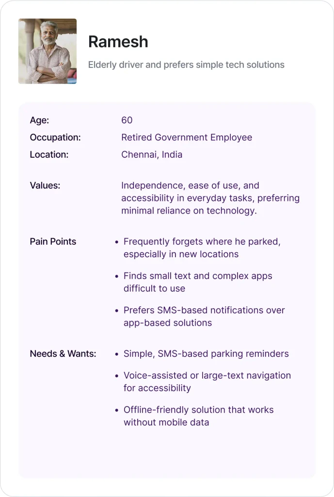
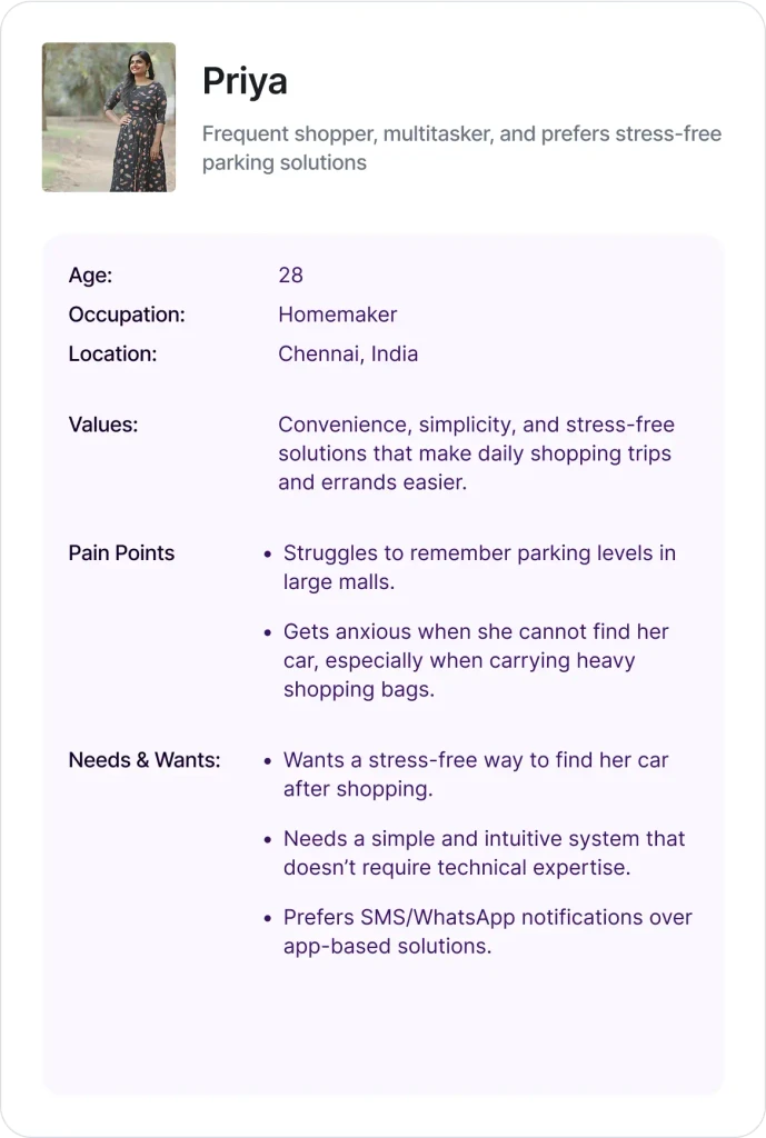
Personas
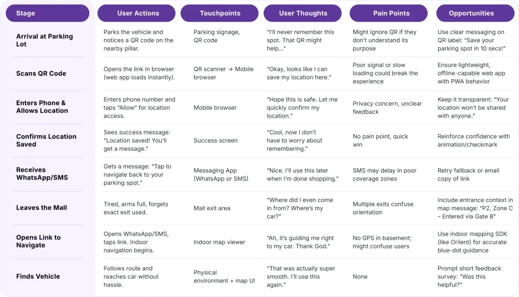
User Journey Map
Concept & Solution
Technical Constraints
Google Maps Limitation in Malls:
What’s Needed to Enable Google Indoor Maps
Alternative Indoor Mapping Solutions
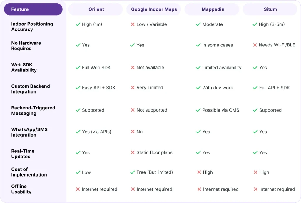
Constraints & Problem Analysis
Contextual Constraints
Technical Limitations
Behavioral Challenges
Final Decision (After Evaluation)
After evaluating cost, ease of integration, and required accuracy, the finalized stack may use:
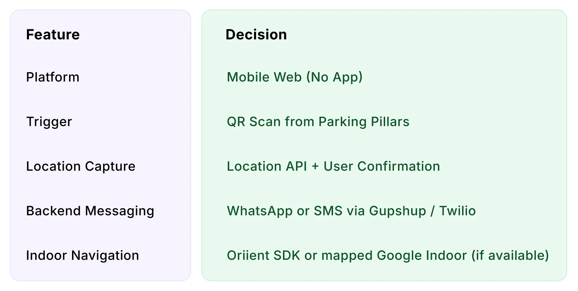
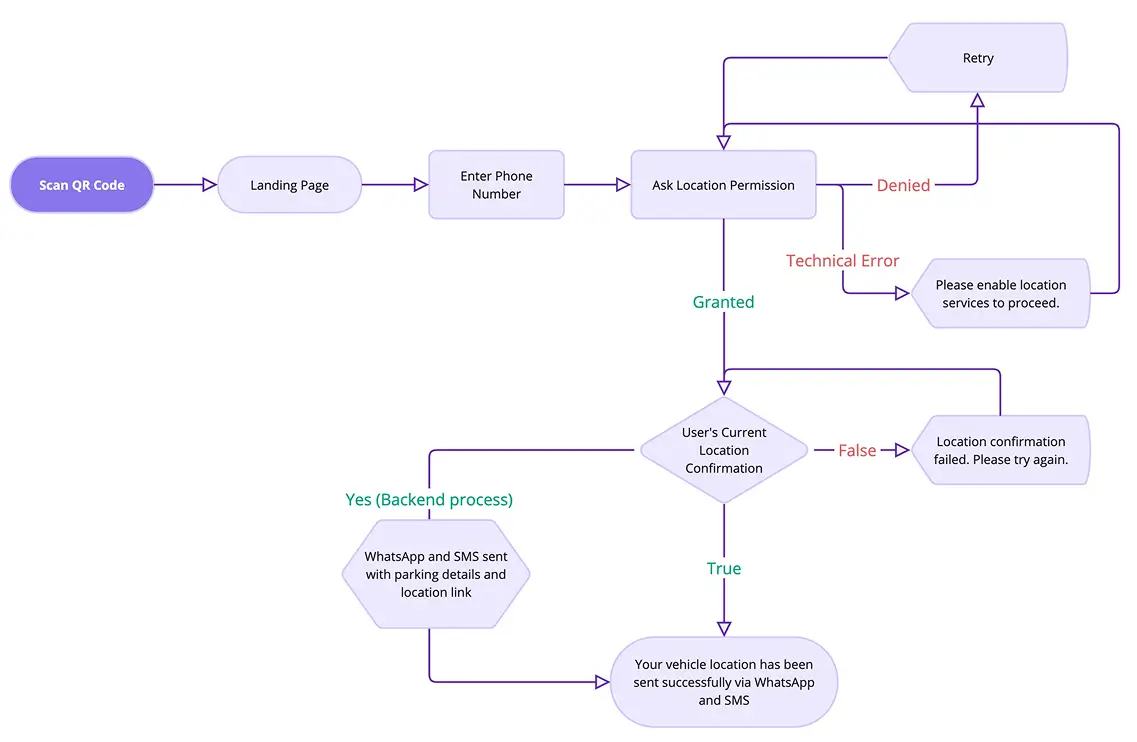
User Flow
Entry Point: Scan QR → Load Web App
Mid Flow: Enter phone number → Allow location → Confirm
Exit Point: Backend stores data → Sends pre-written message via WhatsApp with indoor route link
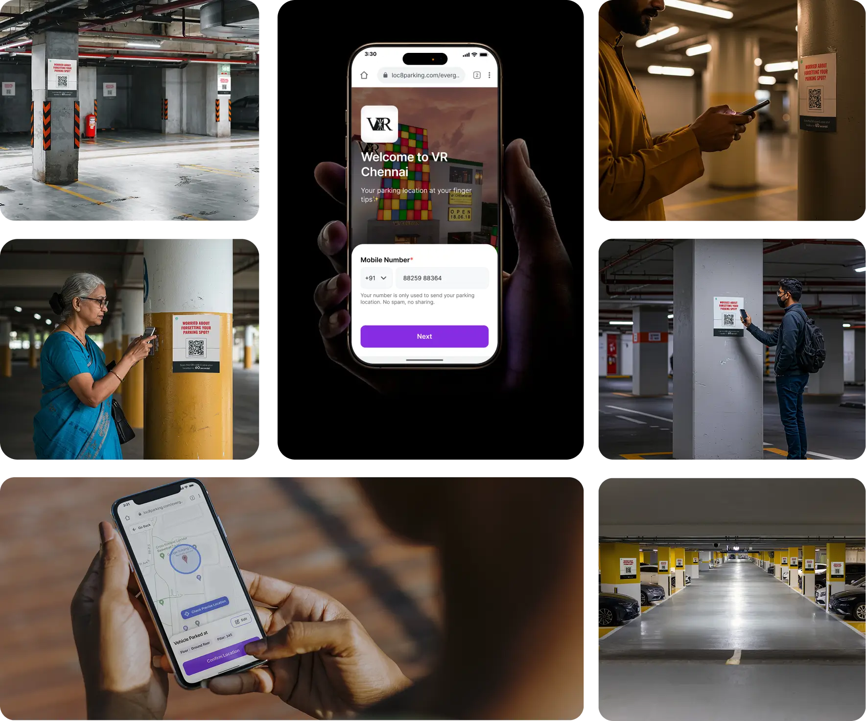
Low-Fidelity Wireframes
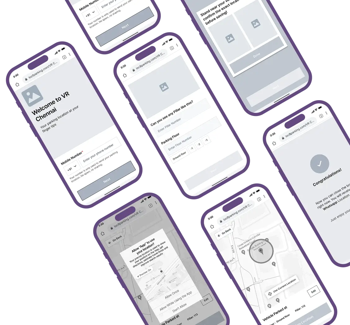
Welcome Screen
Phone Number Input
Location Confirmation
Task Success
Navigation UI
Indoor route guidance via Google Maps
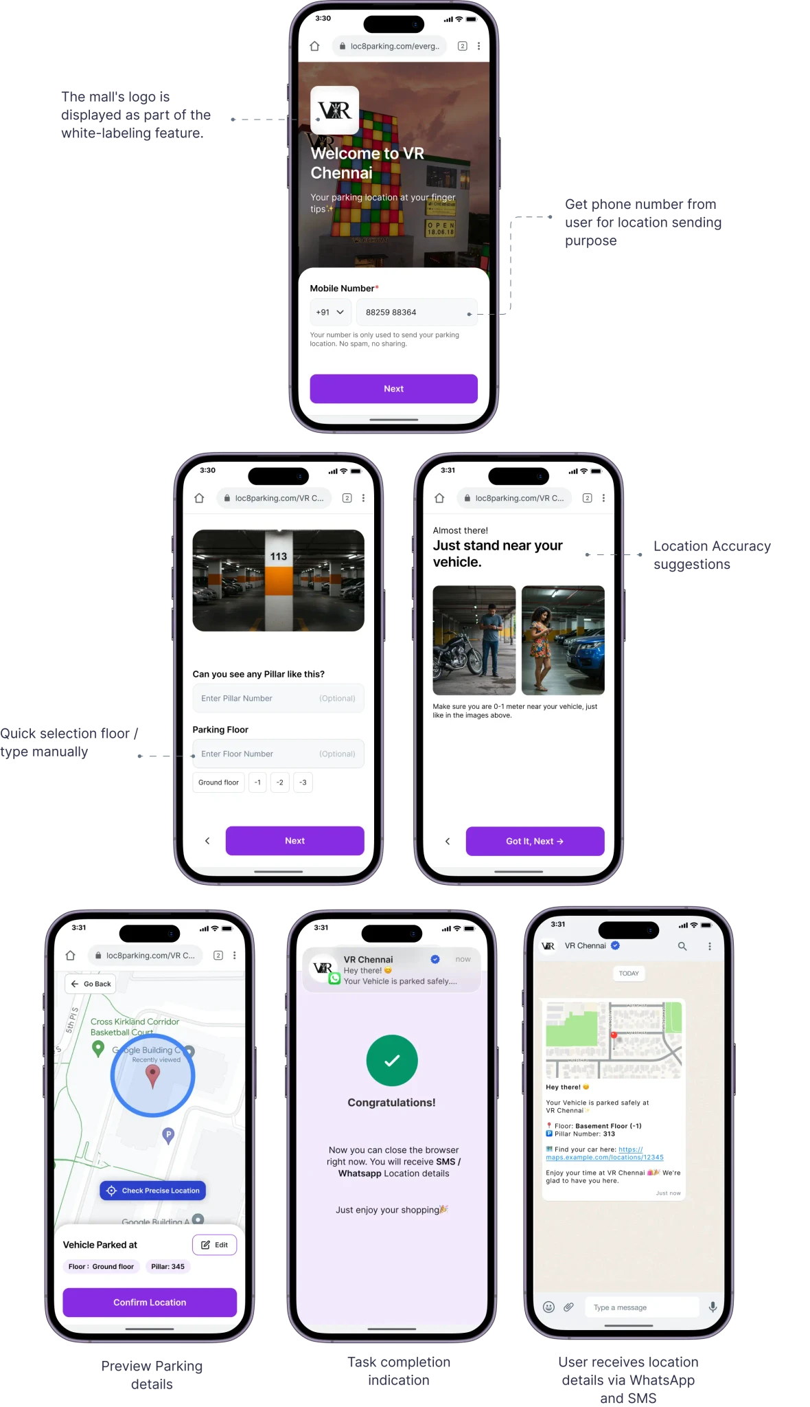
High-Fidelity Prototype
Users guided through 3-4 screens max.
Each screen optimized for mobile readability and tap zones.
WhatsApp message includes location context + floor + pin.
Anticipated Impact on Users
While this is a conceptual project, the solution was designed to address clear pain points identified through user research and behavioral insights. If implemented, it could potentially result in:
Faster vehicle recall
(in < 60 seconds), reducing user frustration after long visits.
Frictionless experience
Using a no-download, web-based interface.
Improved in-mall navigation
Via precise location guidance inside complex structures.
Personal Impact
User-centered research synthesis
Planning backend-triggered logic (SMS/WhatsApp automation)
Evaluating indoor navigation technologies (Google Maps, Oriient, etc.)
Making product decisions based on feasibility, constraints, and user needs